TensorFlight provides high-quality data on commercial properties generated from images using state-of-the-art AI. Using different imagery sources from different perspectives (satellite, aerial, drone and street view) we are able to extract reliable data.
Current capabilities of TensorFlight
Current capabilities
Object type | Output type | Explanation | Example |
|---|---|---|---|
| Commercial building footprint | Polygon | Footprint of commercial or industrial building - e.g. shopping mall or gas station. | 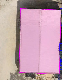 |
| Residential building footprint | Polygon | Footprint of residential building - either house or block of flats. | 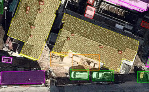 |
| Temporary building footprint | Polygon | Building-like structure that is not permanent - e.g. tent or trailer. | 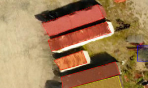 |
| Missing part of building | Polygon | Part of the building that is missing a standard structure - e.g. it is still in construction or part of the roof that have been torn by a Hurricane |  |
| Building degradation | Polygon | Property degradation that is not affecting a structural integrity of the property - e.g. pooling water, missing shingles, facade paint cracking. | 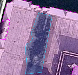 |
| Tree | Bounding box | Tree - posing risk of catching fire or falling under heavy wind. | 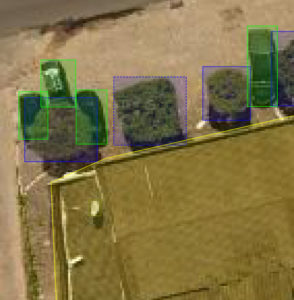 |
| Dead tree | Bounding box | Dead tree is likely dead, so it's posing higher risk of fire and wind than tree with leaves. |  |
| Vehicle | Bounding box | Vehicle - e.g. car, truck or ship | 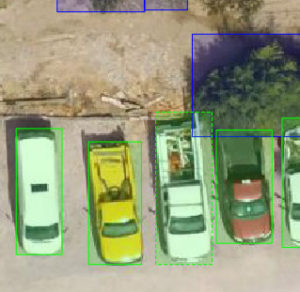 |
| Parking space | Bounding box | Parking space - counting empty parking spots helps estimate activity around the property. |  |
| Solar panels | Polygon | Group of solar panels. If multiple solar panels are adjacent they are counted as a one group. | 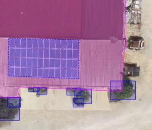 |
| Wind-borne debris | Bounding box | Items nearby property that can be blown by the wind and damage the property envelope - e.g. chairs, lumber, piles of trash. | 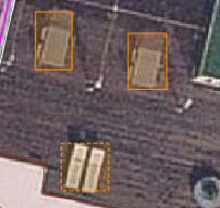 |
| Mechanical euipment on the roof | Bounding box | Mechanical equipment on the roof, that can be blown by the wind - e.g. HVAC. | 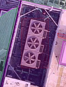 |
| Pool | Polygon | Swimming pool. Other water sources like ponds or fountains are not included |  |
| Window or skylight | Polygon | Either skylight on the roof or window on the facade. | 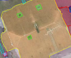 |
| Antenna or satellite dishes | Bounding box | Antennas or satellite dishes on the roof that can be blown by the wind. | 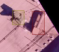 |
| Construction type | Classification | Classification of construction type - e.g. wood frame, masonry, tilt-up, engineered structure | |
| Number of stories | Classificiation | Count of stories in the building. | |
| Occupancy type | Classifitcation | Type of building usage - e.g. Retail trade, Professional technical and business, Apartment/Condo, Restaurants. | |
| Signage | Bounding box | A sign that allows to extract more information about the business or pose a risk of blowing by the wind. |  |
| Door or gate | Polygon | Door, if visible from imagery. | 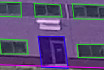 |
| Building height | Regression | Height of building in meters. | |
| Estimated building age | Regression | Estimate building age based on the visual characteristics. | |
| Roof shape | Classificiation | Flat, low/moderate/steep pitch. | |
| Roof material | Classification | E.g. metal, shingle, tile. | |
| Roof age | Regression | Time since roof was remodeled last time. |
Customization and other items
For client needs we also prepare individual projects that consist of:
- Improving accuracy of existing classes. We usually can reach 90%+ accuracy of direct work on a specific class in 2-8 weeks given priorities specified by the client.
- New object types. We can add also add new object classes upon request. It usually takes between 1 and 3 months to support a new object class.
How TensorFlight will deliver data results to me?
- Web dashboard: Web dashboard that allows users to request new processing or view and edit results of our analyses. Please create an account and explore the dashboard at https://tensorflight.com/app .
- GeoJSON: Standard format for describing GIS polygons easily integrated with web mapping tools available via the API accessible via an API.
- Shapefile: Shapefile is one of standard GIS formats that can be easily imported into tools like ArcGIS or QGIS available via the API of the dashboard.
- Vector tiles: URLs to slippy map tiles with vectors that can be overlaid on top of web based mapping tools available via the API. Example tile.
Output type
Bounding box
Rectangle around the object – min/max latitude/longitude.
Using this output type you can estimate object dimensions – e.g. bigger HVAC or bigger trees pose higher risk in case of a heavy wind. Based on object location we can also understand magnitude of the risk – e.g. tree or wind-borne debris dangerously close to the property is more likely to cause damage.

